.png)
Designated Rivers
Blackburn Fork Scenic River | Buffalo Scenic River | Clinch Scenic River | Collins Scenic River
Conasauga Scenic River | Duck Scenic River | Duskin Creek | French Broad Scenic River | Harpeth Scenic River
Hatchie Scenic River | Hiwassee Scenic River | Little Piney Creek | Piney River| Roaring River Scenic River | Spring Creek Scenic River | Soak Creek Scenic River | Tuckahoe Creek Scenic River | Obed Scenic River
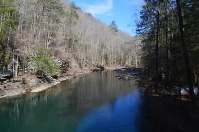
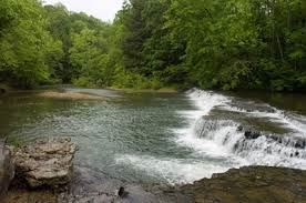
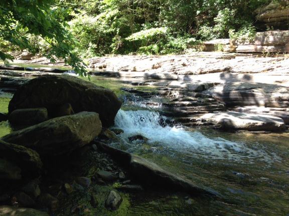
Blackburn Fork Scenic River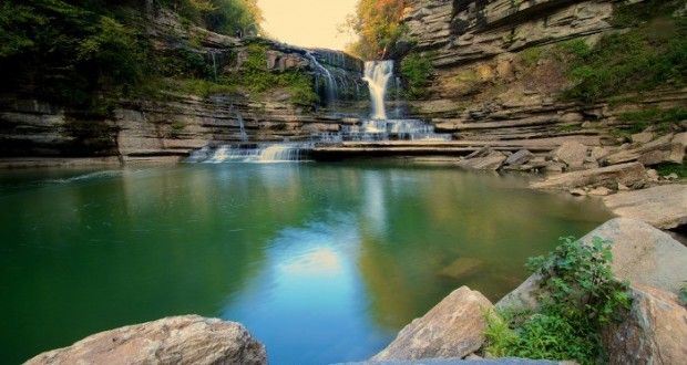
Class I Natural Area ~ from Cummings Mill Road downstream for 1.5 miles
Class II Pastoral River Area ~ 1.5 miles downstream of Cummins Mill Road approximately 12.5 miles downstream to the confluence of the Roaring River.
Designated: 1974
Location: Jackson County
Attractions: Cummins Falls State P ark
390 Cummins Falls Lane Cookeville, TN 38501 (931) 261-3471 (Ranger mobile #)
Activities: Hiking, Swimming Fishing
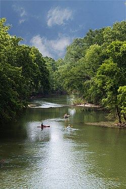
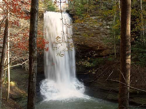
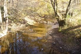
Blackburn Fork River is located on the Highland Rim in the Upper Cumberland Plateau. It is a tributary of the Roaring River originating near Cookeville, Tennessee. The rivers most significant geological, scenic and recreational feature is Cummins Falls. It is the eighth largest waterfall in Tennessee and is located within Cummins Falls State Park. The park provides a ½ mile hiking trail to the overlook and a 1.6 mile trail to the popular swimming hole at the base of the falls. Smallmouth Bass are a favorite catch for anglers wading the river or fishing from the rocky bank.
 Buffalo Scenic River
Class II Pastoral River Area ~ the entire section of the Buffalo River in Lawrence County. (see Acts 1969, ch. 31, § 1).
Designated: 1969
Location: Lawrence County
Public Access: Lawrence County Highway Bridge at Henryville, Tennessee 35°23'48" N, 87°23'18" W, one mile east of Henryville on County Road 6230.
Activities: Canoeing, Kayaking, Fishing.
The river is named for the Buffalo fish which is abundant in its lower reaches.
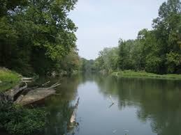
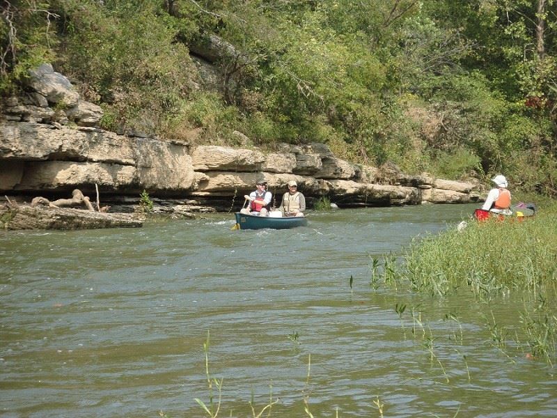
The Buffalo River is the longest un-impounded river in middle Tennessee and the longest tributary of the Duck River. It meanders 125 miles through the southern and western portions of middle TN supporting a diversity of wildlife including nearly 85 species of fish. Canoeing and kayaking are especially popular in the middle and lower reaches of the river because of its scenic beauty and fishing opportunities. The upper portions of the river between Henryville and Flatwoods, TN are floatable from November through August, while the remainder of the river is floatable year-round. Local companies rent canoes, kayaks and tubes and coordinate trips, including over-night camping trips. Personal craft can be launched from the TWRA access point along the river below the headwaters in Henryville. Most of the land along the river is privately owned.
Clinch Scenic River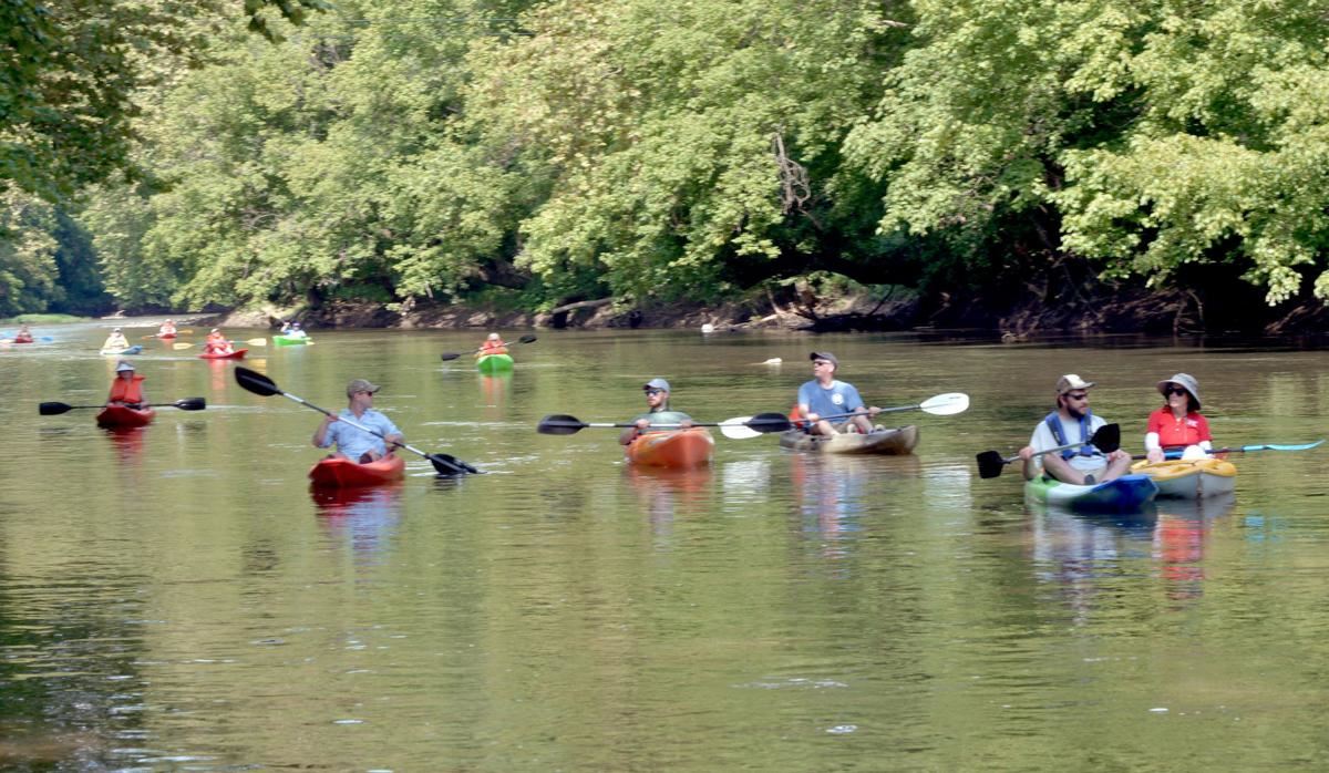
Class II Pastoral River Area ~ the entire section of the Buffalo River in Lawrence County. (see Acts 1969, ch. 31, § 1).
Designated: 1996
Location: Lawrence County Public Access: Lawrence County Highway Bridge at Henryville, Tennessee 35°23'48" N, 87°23'18" W, one mile east of Henryville on County Road 6230. Activities: Canoeing, Kayaking, Fishing.
In the Cherokee language, the name of the river is said to mean “winding waters”.
The Clinch River rises in Southwest Virginia near Tazewell, Virginia and flows nearly 300 miles southwest through the Great Appalachian Valley, gathering various tributaries including the Powell River before joining the Tennessee River in East Tennessee. Before being dammed, the Clinch River was a major producer of freshwater mussels and pearls. A section of the lower Clinch River near Knoxville, Tennessee is designated a scenic river and provides recreational paddling opportunities along the proposed Pellissippi Blueway.
Class II~ Pastoral River Area legislative action excluded all but that segment of the Collins River flowing through the Savage Gulf Natural Area (see Acts 1984, ch. 830, § 1).
Designation: 1984
Location: Grundy County
Attractions: South Cumberland State Park 11745 US 41 | Monteagle , TN 37356 (931)924-2980 Savage Gulf: (931)779-3532
Activities: Hiking
The Collins River originates in the east central portion of Tennessee along the Cumberland Plateau and flows 67 miles to the confluence with the Caney Fork River upstream of Great Falls Dam. The five miles of scenic river lies within a narrow gorge at the Savage Gulf State Natural Area. Like most large streams in the area it flows predominantly underground appearing as a dry stream except during periods of heavy rainfall when it can become swift and treacherous. Waterfalls along this reach drop over limestone ledges and flow into sinks disappearing until resurfacing at the mouth of river. Beyond the scenic river stretch, the Collins River is one of few rivers in Tennessee with a good population of muskie (muskellunge). A strenuous 9 mile loop trail in the Savage Gulf State Natural Area provides the only access to the river gorge. The Collins Gulf Trail is accessible by the Collins West trailhead on 55th Ave. in Gruetli-Laager.
Conasauga Scenic River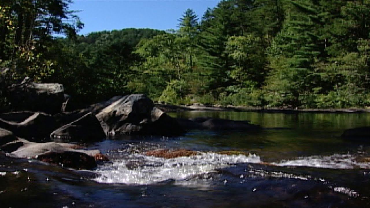
Class I~ Natural River Area the entire segment of the Conasauga River in Polk county, upstream from the Hwy 411 bridge.
Designated: 1969
Location: Polk County
One of two scenic rivers located in the Cherokee National Forest in southeast Tennessee
Attractions:
Conasauga River Trail
Latitude 34.991189, Longitude -84.661046
Ocoee Whitewater Center (423) 496-0100
4400 U.S. 64, Copperhill, TN 37317
Activities: Hiking, Fishing, Kayaking, Mountain Biking, Snorkeling
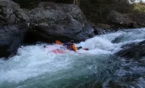
The USDA Forest Service offers guided snorkeling programs for groups of 12-24 people through the Ocoee Whitewater Center. Paddlers, plan to spend the night when paddling Jacks River to the US-411 Bridge. It is a difficult yet popular Class II-III 10.1 mile paddling trip. (coordinates put in 34.98833, -84.64278; Takeout 35.00888, -84.73389). A 6.4 mile loop trail located near Oldfort, Tennessee is primarily used for mountain biking and is accessible year-round. The trail is rated as moderate. Much of the land along the river is privately owned with the exception of the public lands mentioned above.
Class II~ Pastoral River Area that segment of the Duck River beginning at Iron Bridge Road (river mile 136.4) in Maury County extending continuously upstream to the Maury-Marshall County line (river mile 173.7) (see Acts, 2001 ch. 232, §1).
Designated: 2001
Paddling inside a cave on the Duck River
Location: Maury County
Activities: Paddling, Fishing, Swimming, Camping.
The Duck River is 284 miles long and is the longest river located entirely within the state of Tennessee. It originates in the “Barrens” on the Highland Rim in middle Tennessee and flows through seven middle Tennessee counties before reaching it’s confluence with the Tennessee River near New Johnsonville. The river is characteristic of long deep pools and shallow stretches of mini-rapids not to mention Normandy Dam and smaller drops. It’s boundaries include caves, cliffs, waterfalls, farmland, developed communities, two state parks and the Yanahli WMA. It supports more than 50 species of mussels, over 20 species of snails and more than 150 species of fish. It is one of the most bio-divers rivers in the U.S. yet only 32.7 miles is designated a scenic river. The scenic river stretch is bordered primarily by the Yanahli Wildlife Preserve and is part of the Duck River Blueway. Local outfitters rent canoes and kayaks and coordinate trips, including over-night camping trips. Personal craft can be launched from blueway access points and numerous TWRA boat launch areas.
 A tributary of the Piney Scenic River, Duskin Creek Scenic River contains the segment of Duskin Creek from its confluence with Newby Branch in Rhea County downstream to its confluence with Piney River in Rhea County.
Location: Rhea County
This is a Class I Natural Scenic River and was designated in 2020.
Nearby Attractions: Justin P. Wilson Cumberland Trail State Park - From Spring City, take State Route 68 north toward Crossville, or from Crossville travel south on S.R. 68. Look for a convenience store near the bridge over the Piney River. On the same side of S.R. 68 as the convenience store, the first cross street is Shut-In-Gap Road. Turn on there and travel about 1 mile to a parking area on the right by a picnic area at the Piney River. Park here for access to Soak Creek, which is a short walk continuing up Shut-In-Gap Road, across the bridge over the Piney River, to a gated jeep trail going up Soak Creek. Learn more about Cumberland Trail State Park.
Piney Falls State Natural Area - From Spring City take State Route 68 north toward Crossville, or from Crossville travel south on S.R. 68. As you get to the crest of the Cumberland escarpment, you enter the unincorporated town of Grandview. Look for a sign for Piney Falls State Natural Area and turn onto the Fire Tower Road (a.k.a., Hillary Road). The trailhead is on the right approximately one mile from Highway 68 or one-fourth mile before you get to the fire tower, which is located at the end of the road. Learn more about Piney Falls SNA.
Stinging Fork Falls State Natural Area - Learn more about Stinging Fork Falls SNA.
French Broad Scenic River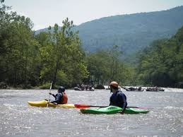
Class III~ Partially Developed River Area from the North Carolina State Line to the confluence at Douglas Lake. Designated
Designated: 1968
Location: Cocke County
Attractions: French Broad River Blueway
170 Lyman St Asheville, NC 28801 (828) 252-8474
Activities: Canoeing, Kayaking, Whitewater Rafting, Fishing
The French Broad River is 213 miles long. It begins just west of the Eastern Continental Divide near Rosman NC and flows into Tennessee where it is impounded behind Douglas Dam and continues to the confluence with the Holston River in Knoxville, TN. Experienced and novice paddlers as well as anglers love the river because of it’s diverse intensity and scenic beauty throughout the seasons. The 33 mile scenic river section provides nine access points along more than forty miles of blueway extending from the NC line to Walters Bridge at river mile 64.4 in Jefferson County. From this point there are no public access areas until you reach Mountain Cove Marina at river mile 32.4 just before Douglas Dam. Whitewater rafting is popular through the Cherokee National Forest from the NC line to Del Rio, TN. Several rafting agencies provide raft and equipment rentals, as well as guided trips along this stretch of river.
Class II~ Pastoral River Area legislative action excluded all but the entire section of the Harpeth River in Rutherford county and Davidson county and re-classified the section of river in Davidson County
Class III~ Partially Developed River Area from Highway 100 to interstate 40 (see Acts 1972, ch. 536, § 1,2; T.C.A., 11-1404). Designation 1972.
Designated: 1972
Location: Rutherford, Davidson County
Attractions: Harpeth River State Park & Blueway
Hwy. 70 Kingston Springs , TN 37887 615-952-2099
Activities: Paddling, Fishing, Swimming, Sightseeing, Bird Watching
The Harpeth River originates in Eagleville, Tennessee and flows nearly 125 miles to the confluence of the Cumberland River near Ashland City. In 2012 removal of a low head dam made it the second longest un-impounded river in middle Tennessee. The scenic river stretch provides recreational, cultural and historic features including a blueway that connects areas of the Harpeth River State Park to surrounding local communities. The river’s diverse landscape is characterized by mixed hardwood forests, majestic bluffs, farmland and developed communities. These attribute to it’s ecological diversity and scenic beauty. Local outfitters rent canoes and kayaks and coordinate trips, including over- night camping trips. Personal craft can be launched at Blueway access points and TWRA boat launch ramps.
Class I~ Natural River Area from the Mississippi state line, approximately 163 miles, to the confluence of the Mississippi River (see Acts, 1970, ch. 437, § 2).
Designated: 1970
The historic remains of a civil war era sidewheel steamship (approximately 204’ in length and a 32’beam) found in the lower Hatchie. The vessel is a registered archeological site.
Location: McNairy, Hardeman, Madison, Haywood, Tipton and Lauderdale Counties
Attractions:
Davis Bridge Battlefield
Essary Springs Road Pocahontas, TN 38061 Phone: (731) 658-6554
Activities: Fishing, Paddling, Sightseeing, Wildlife Viewing.
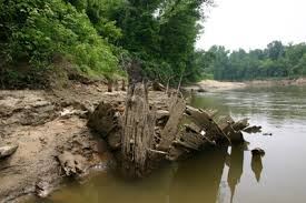
The Hatchie River originates in northern Mississippi and is the longest free-flowing tributary of the lower Mississippi River totaling 238 miles. The scenic river section flows from the Mississippi State line to the confluence with the Mississippi River. It is the only river in Tennessee designated a state scenic river in its entirety. The river has considerable geographic, cultural, and historic significance. River frontage along this slow meandering swamp river with many ox bows is primarily privately owned wilderness (hardwood forests, canebrakes, swamps), and farm land. Two National Wildlife Refuge Areas preserve and protect over 21,000 acres of forested flood plain in Haywood, Lauderdale and Tipton counties. The ecosystem provides habitat for more than 100 species of fish including 11 species of catfish, which is possibly the most of any North American River; 50 species of mammals; 35 species of mussels; 250 species of birds including migrating birds; along with many reptiles, amphibians and invertebrates. The rivers’ historic significance includes national landmarks dating back to the Civil War era. There are 10 TWRA Public boat launch areas along the river.
Hiwassee Scenic River
Class III~ Partially Developed River Area from the TN Hwy 411 Bridge to the North Carolina state line (see Acts, ch. 540,§ 5).
Designated: 1968
Location: Polk County
Attractions:
Hiwassee-Ocoee State Park
404 Spring Creek Road PO Box 5 Delano, TN 37325 423-263-0050
Activities: Canoeing, Kayaking, Rafting, Fishing, Hiking, Camping
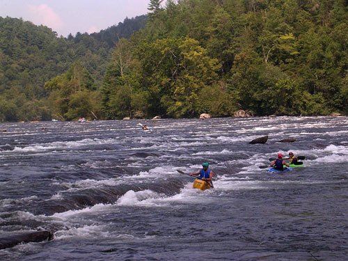
The Hiwassee River originates on the north slope of Rocky Mountain, Georgia and flows 147 miles to its confluence with the Tennessee River. The section of the river from the NC state line to Delano, TN is designated a scenic river and is a popular paddling destination featuring flat water and whitewater class I, II, and III rapids. The State Park and Cherokee National Forest offer hiking trails, camping and several public launch areas. Local rafting agencies provide raft and equipment rentals, as well as guided rafting and fishing trips. Much of the land along the river is privately owned with the exception of the public lands mentioned above.
Class I~ A tributary of Soak Creek Scenic River, Little Piney Creek Scenic River is comprised of the continuous segment of Little Piney Creek entirely within Piney Falls State Natural Area in Rhea County downstream to its confluence with Soak Creek in Rhea County
Designated: 2020
Location: Rhea County
Attractions:
Justin P. Wilson Cumberland Trail State Park - From Spring City, take State Route 68 north toward Crossville, or from Crossville travel south on S.R. 68. Look for a convenience store near the bridge over the Piney River. On the same side of S.R. 68 as the convenience store, the first cross street is Shut-In-Gap Road. Turn on there and travel about 1 mile to a parking area on the right by a picnic area at the Piney River. Park here for access to Soak Creek, which is a short walk continuing up Shut-In-Gap Road, across the bridge over the Piney River, to a gated jeep trail going up Soak Creek. Learn more about Cumberland Trail State Park.
Piney Falls State Natural Area - From Spring City take State Route 68 north toward Crossville, or from Crossville travel south on S.R. 68. As you get to the crest of the Cumberland escarpment, you enter the unincorporated town of Grandview. Look for a sign for Piney Falls State Natural Area and turn onto the Fire Tower Road (a.k.a., Hillary Road). The trailhead is on the right approximately one mile from Highway 68 or one-fourth mile before you get to the fire tower, which is located at the end of the road. Learn more about Piney Falls SNA.
 Piney River
Class I~ Natural River Area Piney Scenic River is the segment of Piney River in Rhea County from its confluence with Moccasin Creek downstream to its confluence with Rockhouse Branch.
Designated: 2020
Location: Rhea County
Attractions:
Justin P. Wilson Cumberland Trail State Park - From Spring City, take State Route 68 north toward Crossville, or from Crossville travel south on S.R. 68. Look for a convenience store near the bridge over the Piney River. On the same side of S.R. 68 as the convenience store, the first cross street is Shut-In-Gap Road. Turn on there and travel about 1 mile to a parking area on the right by a picnic area at the Piney River. Park here for access to Soak Creek, which is a short walk continuing up Shut-In-Gap Road, across the bridge over the Piney River, to a gated jeep trail going up Soak Creek. Learn more about Cumberland Trail State Park.
Piney Falls State Natural Area - From Spring City take State Route 68 north toward Crossville, or from Crossville travel south on S.R. 68. As you get to the crest of the Cumberland escarpment, you enter the unincorporated town of Grandview. Look for a sign for Piney Falls State Natural Area and turn onto the Fire Tower Road (a.k.a., Hillary Road). The trailhead is on the right approximately one mile from Highway 68 or one-fourth mile before you get to the fire tower, which is located at the end of the road. Learn more about Piney Falls SNA.
Stinging Fork Falls State Natural Area - Learn more about Stinging Fork Falls SNA.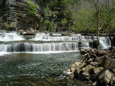
Roaring River Scenic River
Class I~ Natural River Area from the TN Hwy 136 bridge extending 2.0 miles downstream;
Class II~ Pastoral River Area from 2.0 miles downstream of the SR-136 bridge, approximately 19 miles, to the confluence of the Cumberland River at Cordell Hull Lake.
Designated: 1974
Location: Jackson County, Overton County
Attractions:
Roaring River Falls The Boils WMA
Highway 136 Cookeville, TN 38501 36.351011°N 85.564184°W
Roaring River Recreation Area 615-735-1034, 71 Corps Lane, Carthage, TN 37030-9710
Activities: Sightseeing, Canoeing, Kayaking, Fishing.
The Roaring River originates on the Highland Rim near Livingston, Tennessee and flows 37.7 miles to the confluence of Cordell Hull Lake. At the confluence is the U.S. Army Corps of Engineers Roaring River Recreation Area. It offers picnic areas, a campground and boat launch. Further upstream is the Boils Wildlife Management Area so named because at this point the rivers fast moving water runs into slower moving water that is pooled creating the appearance of boiling water.
The Boils WMA is a popular paddling destination and wildlife viewing area. Kayakers can access the river here or further upstream at the TWRA put-in. Another scenic river attraction is Roaring River Falls located on Hwy 136.
Spring Creek Scenic River
Class I~ Natural River Area Waterloo Mill, downstream approximately 4.4 miles, to the Overton-Jackson County line;
Class II~ Pastoral River Area from the Overton-Jackson County line, downstream approximately 4.6 miles, to the confluence of the Roaring River.
Designated: 1974
Location: Jackson County, Overton County
Attractions: Waterloo Falls
Highway 135 Cookeville, TN 38501
Activities: Sightseeing
Spring Creek is located along the Upper Cumberland Plateau near Cookeville, Tennessee. Like Blackburn Fork River it is a tributary of the Roaring River with no public canoe/kayak access points. Spring Creek Gorge and Waterloo Falls are the most significant geological features of the scenic river. Visitors can hike a ½ mile unimproved trail into the gorge from a pull off on Hwy 135 to view the cascading waterfall.
Soak Creek Scenic River
Class III~ Developed River Area That segment of Soak Creek in Bledsoe County from its confluence with Georgia Branch continuing to a point downstream to its confluence with the Piney River in Rhea County.
Designated: 2016
Read more about Soak Creek's designation here.
Location: Bledsoe & Rhea County
Attractions:
Justin P. Wilson Cumberland Trail State Park
From Spring City, take State Route 68 north toward Crossville, or from Crossville travel south on S.R. 68. Look for a convenience store near the bridge over the Piney River. On the same side of S.R. 68 as the convenience store, the first cross street is Shut-In-Gap Road. Turn on there and travel about 1 mile to a parking area on the right by a picnic area at the Piney River. Park here for access to Soak Creek, which is a short walk continuing up Shut-In-Gap Road, across the bridge over the Piney River, to a gated jeep trail going up Soak Creek.
Piney Falls State Natural Area
From Spring City take State Route 68 north toward Crossville, or from Crossville travel south on S.R. 68. As you get to the crest of the Cumberland escarpment, you enter the unincorporated town of Grandview. Look for a sign for Piney Falls State Natural Area and turn onto the Fire Tower Road (a.k.a., Hillary Road). The trailhead is on the right approximately one mile from Highway 68 or one-fourth mile before you get to the fire tower, which is located at the end of the road.
Stinging Falls State Natural Area
Stinging Fork Falls is located west of Spring City. Access to the natural area is via Highway 68. In Spring City turn onto Shut-In Gap Road and proceed five miles to the parking area on the right.
Activities: Whitewater paddling, fishing, hiking
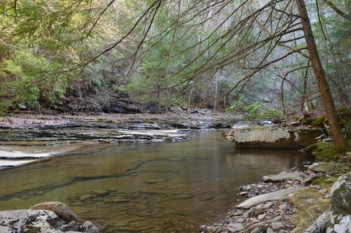
Soak Creek originates in Cumberland County Tennessee and flows down the Cumberland Plateau into a remote cliff-lined canyon of primitive Appalachian wilderness to its confluence with The Piney River near Spring City, Tennessee. This free-flowing river serves as a critical habitat for the iconic species of the Cumberland Plateau, and when flows rise following rains, offers whitewater paddlers a scenic Class III descent. Hikers on the Cumberland Trail can also benefit from a recent land conservation purchase that borders Soak Creek creating a corridor between Piney Falls State Natural Area and Stinging Fork Natural Area.
Tuckahoe Creek Scenic River
Class III~ Developed River Area the entire creek.
An urban creek flowing through Knoxville TN to the French Broad River.
Designated: 1968
Location: Knox County
Activities: Sightseeing
Cemetery | Knoxville, TN 37932
Tuckahoe Creek Originates in Jefferson County, Tennessee and meanders 16.1 miles along farmlands and rural communities to the confluence of the French Broad River in Sevier County, Tennessee. While sections of the creek support some fish habitat, privately owned pastures, forests, and residential lands make public access to the creek nearly impossible.
Obed Scenic River
Class III/IV Scenic River Area the section from the western edge of the Catoosa Wildlife Management Area to the confluence with the Emory River; Clear Creek from the Morgan County line to the confluence with the Obed River, Daddy’s Creek from the Morgan County line to the confluence with the Obed River; and the Emory River from the confluence with the Obed River to the Nemo Bridge.
Designated: 1976
Location: Morgan County
Attractions:
Obed Scenic River National Park | (423)346-6294
208 North Maiden Street | Wartburg, Tennessee 37887
Activities: Paddling, Fishing ,Rock climbing, Hiking, Bird Watching, Camping
The only National Wild and Scenic River in Tennessee.
The Obed river originates near Crossville, Tennessee and flows to the mouth of the Emory River. Clear Creek and Daddy’s Creek are tributaries of the river and are included in the National Wild and Scenic Rivers Program. The Obed provides habitat for several threatened and endangered fish and 13 species of crayfish. Visit and enjoy the many recreational opportunities of the Obed Wild and Scenic River Area. Test your strength, endurance, and dexterity while rock climbing or enjoy hiking a relaxing or challenging trail. More calming activities include bird watching and camping. Six public river access areas accommodate canoes, kayaks, and rafts providing flat water and whitewater excitement and adventure. Bring your fishing tackle. Muskalunge and Smallmouth Bass are a favorite among anglers. The Obed Wild and Scenic River Area is managed by the National Park Service. The WMA boundary is managed by the TWRA.